Mount Molloy
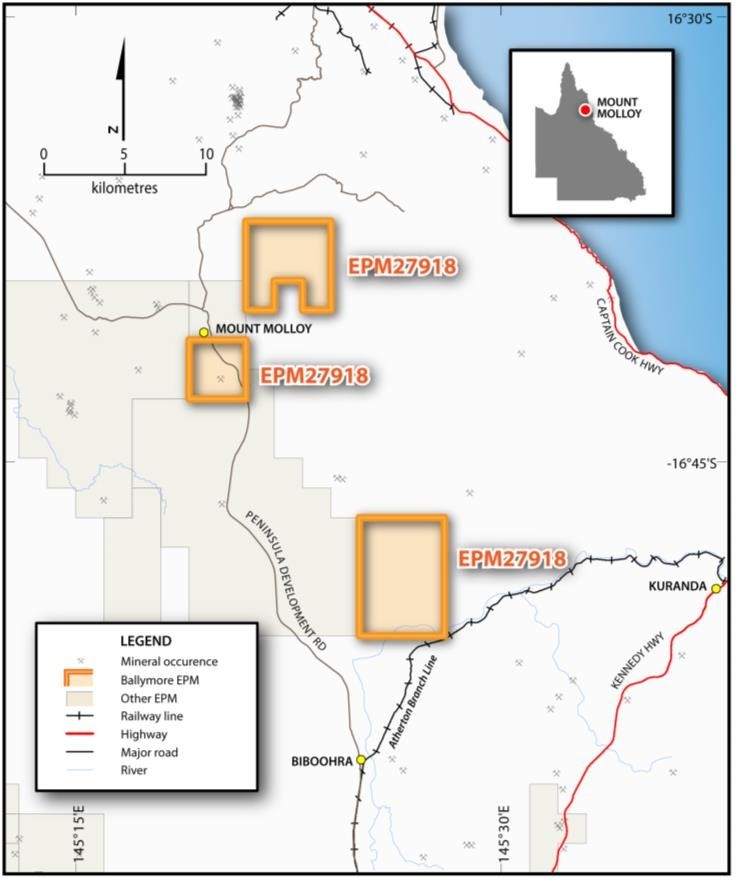
The Mount Molloy Project comprises one granted EPM covering an area of 78km2 and is located south of the town of Mount Molloy and 50 km northwest of Cairns. Mount Molloy represents a high-grade volcanogenic-hosted massive sulphide (“VHMS”) copper deposit that was discovered in 1883. The deposit was mined intermittently from 1883 to 1942 with ore zones assaying up to 20% copper. There was also a significant amount of high-grade zinc ore encountered, but this was not mined due to the lack of market at the time. Production figures are incomplete, although records suggest a total of 43,600 tons of ore was mined, producing 3,900 tons of copper metal at 8.7% Cu.
Previous field work completed by Ballymore has located significant copper mineralisation at Mount Molloy with rock chip samples reporting up to 31.81% Cu, 2.28% Zn and 300 g/t Ag. Soil sampling has defined a significant copper-in-soil anomaly over the main Mount Molloy mine area, as well as a significant anomaly, located north of the mine area, centred over a hill with a historic adit developed into it through copper-stained brecciated sediments. This anomaly remains open to the north and south and is untested by drilling, with the focus of previous drilling being on testing the mine area.
About Mount Molloy
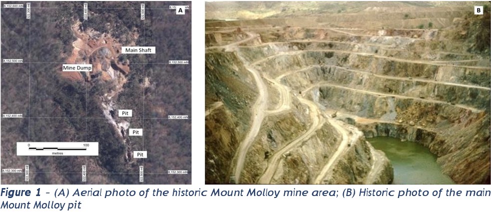
Mount Molloy hosts stratiform copper-zinc mineralisation which occurs within an interbedded pyritic black shale and quartzite sequence that is 60-80m thick. The mine workings, and other pits and gossans in the local area occur along the outcropping prospective horizon. The massive sulphide zones contain copper and zinc in thicknesses up to 4m with lower grade stockwork mineralisation occurring in the footwall.
Mineralisation was first discovered at Mount Molloy in 1883 by Patrick Molloy, after whom the town of Mount Molloy was named. Initially, minor mining of oxidised ore took place until 1902. John Moffat of Irvinebank incorporated Mount Molloy into his mining and metals empire and built a smelter 3km away from the mine, close to the township of Mount Molloy, in 1904. The main mining period occurred from 1905 to 1907, when operations ceased due to falling copper prices. The mine was briefly re-worked by a syndicate in 1918 and again in 1941 to 1942.
The deepest shaft is reported to have reached 143m with ore zones assaying up to 20% copper with widths up to 4m. There was also a significant amount of high-grade zinc ore encountered, but this was not mined due to the lack of market at the time. Production figures are incomplete, although records suggest a total of 43,600 tons of ore was mined producing 3,900 tons of copper metal at 8.7% Cu1.
A number of smaller mines were operated during the same period within the EPM area to the north and south of the Mount Molloy mine with workings hosting copper and zinc ore. Unfortunately, very few records are available for these old workings. A number of small mining leases have also been held over the Mount Molloy mine area in the 1970’s and 1980’s but no further production has been reported.
The Project area also has potential to host tungsten mineralisation and other critical minerals. Tungsten mineralisation occurs discontinuously along the southwestern and western margin of the Permian Mount Carbine Granite and Mareeba Granite which occur between Mount Molloy and Mount Carbine. Mineralisation occurs in the form of wolfram with subordinate scheelite and is associated with quartz- feldspar pegmatite dykes and veins related to the emplacement of the Mareeba Granite. The main tungsten mine in the area is EQ Resources’ Mount Carbine deposit, located 25km northwest of Mount Molloy.